European scientists use AI to predict and prevent wildfires
Portugal is also investing in artificial intelligence to monitor the cleanliness of fuel management strips in the NOVA FCT Clean Forest project.

European researchers, including Portuguese ones, are using artificial intelligence to revolutionize forest fire forecasting.
The European Centre for Medium-Range Weather Forecasts has developed a new model called “Fire Probability” that uses machine learning to analyse large volumes of data and more accurately predict where fires might start.
In Portugal, artificial intelligence is being used to prevent fires with the “Clean Forest” project developed by researchers at NOVA FCT, which monitors the cleanliness of fuel management strips.
Predict the exact location where a fire could break out
Artificial intelligence is revolutionizing wildfire forecasting, enabling more accurate assessment of risk, not just based on weather conditions, but also factors such as the amount of vegetation available to burn and potential ignition sources.
The model developed by scientists at the European Centre for Medium-Range Weather Forecasts (ECMWF) promises to identify more accurately the places with the greatest potential to burn.
It’s more than predicting danger: it’s pinpointing the exact location where a fire could break out.
“In some ways it’s a step change in fire forecasting because we’ve gone from suggesting where fire danger might occur to saying: this is where we think fires are actually going to occur. So it’s a big step forward,” ECMWF climate scientist Joe McNorton told Reuters.
An intelligent model to predict fires
The European Centre for Medium-Range Weather Forecasts (ECMWF) has developed a new model called Fire Probability, which uses machine learning to analyse large volumes of data and more accurately predict where fires are likely to start.
Current forecasts are based on the Meteorological Fire Index, a system that considers four variables: temperature, wind, precipitation and humidity. However, this method has several limitations, explained Joe McNorton.
“Historically, to predict wildfires, we’ve used what’s called the Fire Weather Index. It’s a simple, physics-based model that uses four weather variables – temperature, wind, precipitation and humidity – to predict how intense a fire will be if it does happen. But we know that this model leaves out a lot of important factors – it doesn’t take into account fuel, it doesn’t take into account ignition sources,” the scientist said.
By integrating data on the vegetation present – the fuel – and on possible ignition sources, such as lightning or human activity, the ECMWF model can go beyond simply identifying danger – it can now indicate the real probability of a fire starting in a specific location.
“With all of this, we can predict not only the fire danger, but the actual probability of a fire starting in a specific location,” McNorton said.
New model predicted the start of the Los Angeles fire
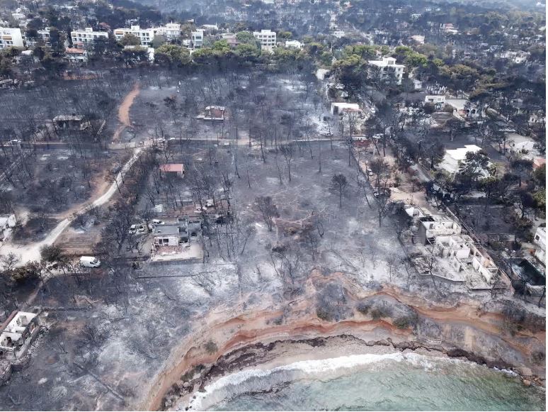
One of the most striking recent examples occurred in January in Los Angeles, when wildfires killed 28 people and destroyed around 16,000 structures.
For example, in a recent case in Los Angeles, the fire started right in the transition zone between the urban area and the forest, which made the situation particularly serious. This is because the previous season had been marked by very wet conditions, which led to an abundant growth of vegetation – that is, fuel – that ended up burning during the fire. ”
This new method, based on the probability of fire occurrence, “incorporates the ‘memory’ of this abundance of fuel into its formulation, which allowed us to identify the regions that could be most severely affected – unlike models that only consider meteorological conditions. Therefore, in this case, our prediction was much more accurate and was even able to indicate the exact location, very close to Los Angeles, where the fire ended up breaking out”, he said.
Monitor the cleanliness of fuel management strips
In Portugal, Artificial Intelligence is also used to prevent fires.
The Floresta Limpa project , coordinated by NOVA LINCS at the Faculty of Science and Technology of Universidade Nova de Lisboa , focuses on continuous monitoring of fuel management zones (FGCI), using artificial intelligence and machine learning algorithms to detect faults and monitor the evolution of combustible material. The platform automatically assesses compliance with legislation requiring the cleaning of these areas to stop the spread of fires.
One of the main innovations is the mobile application for local authorities and the population to report, consult and monitor the cleaning status of the FGCI in municipalities such as Almada, Mação and Santarém, with the ambition of extending coverage to the entire national territory .
The system integrates satellite data, namely vegetation index patterns, and allows the collection of updated and reliable information on the state of the strips, helping to plan cleaning actions and reinforcing monitoring.
Hottest year on record has worsened fires
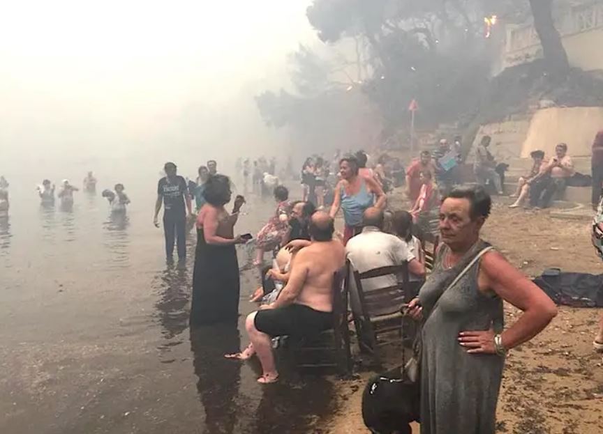
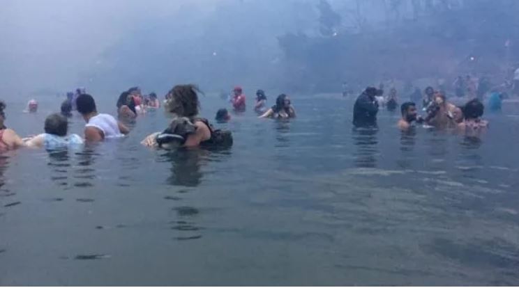
In 2024, record levels of greenhouse gases contributed to the hottest year on record , with extreme weather events affecting several continents. Wildfires displaced 800,000 people, the highest number since systematic data collection began in 2008.